Advanced Offshore Mapping for Energy, Infrastructure & Environmental Projects
Comprehensive offshore and nearshore solutions for safe, informed decision-making
Why Choose Our Marine Survey Services?
Full-Spectrum Capabilities – From shallow coastal surveys to deep ocean mapping
Cutting-Edge Vessel Fleet – Equipped with latest geophysical systems
ISO-Compliant Data – Meeting IMCA standards
Global Offshore Experience – 20+ successful marine projects
Our Marine Survey Solutions
High-Resolution Geophysical Surveys
Multibeam Bathymetry (up to 30m depth or below)
Side Scan Sonar (object detection to 1cm resolution)
Sub-Bottom Profiling (sediment layers to 30m below seabed)
Our Marine Survey Capabilities
Hydrographic Surveys High-resolution bathymetric mapping using multibeam and single-beam echo sounders to chart seabed topography, dredging volumes, and navigational hazards.
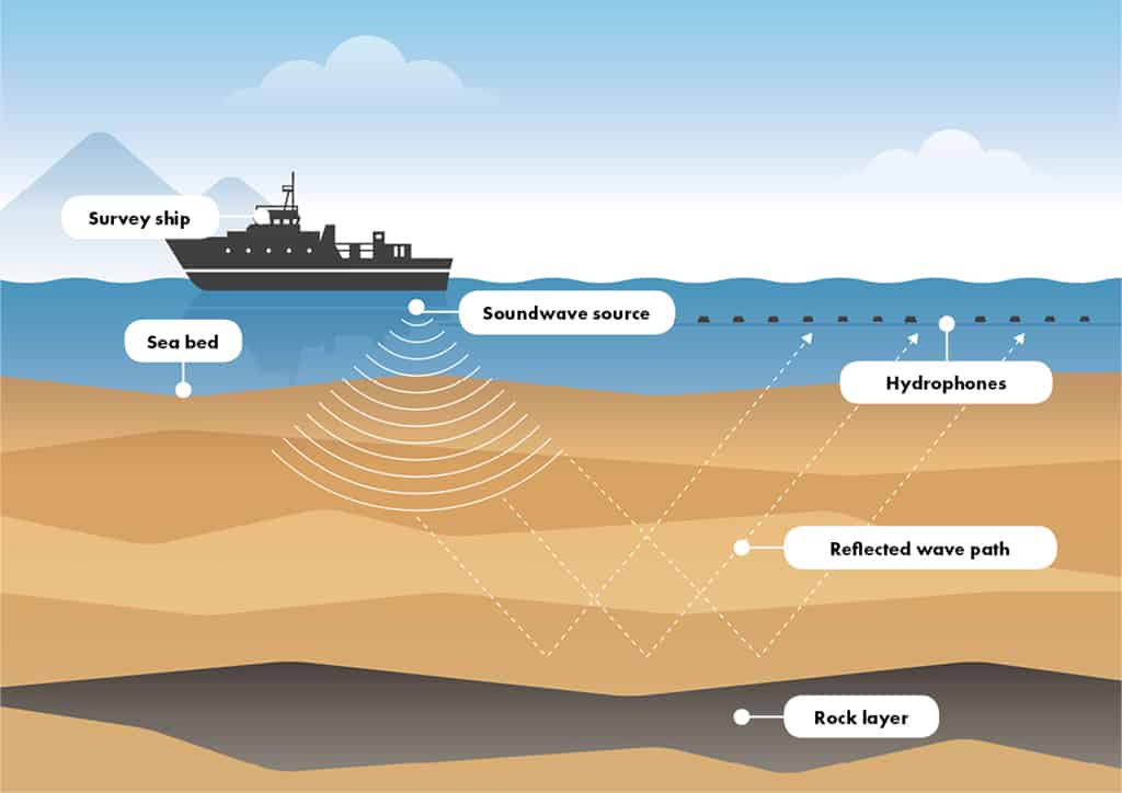
Geophysical Surveys Sub-bottom profiling, side-scan sonar, and magnetometry to detect buried pipelines, cables, UXO, and geological features beneath the seabed.
Geotechnical Investigations Cone Penetration Testing (CPT), vibrocore sampling, and borehole logging to assess soil strength, stratigraphy, and foundation suitability.
Environmental Baseline Surveys Water and sediment sampling, benthic habitat mapping, and ecological assessments to support EIAs and regulatory compliance.
ROV & Diver Inspections Visual inspections of subsea structures, pipelines, and moorings using Remotely Operated Vehicles (ROVs) or certified divers.
Marine Warranty & Vessel Condition Surveys Ensuring safety, compliance, and insurability for offshore operations, cargo transport, and marine assets.